Subway Sorter

The design-research leading to Subway Sorter is rooted in an ongoing interest in the representation of traffic – here in the form of public underground transportation – as a means of spatial-temporal mapping of the city. Starting from the subway system of Manhattan, this comparative study models several metropolis’ of the 21 century.

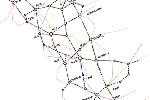
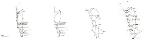
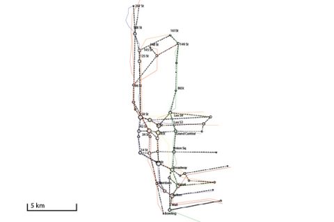
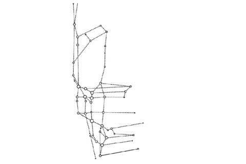
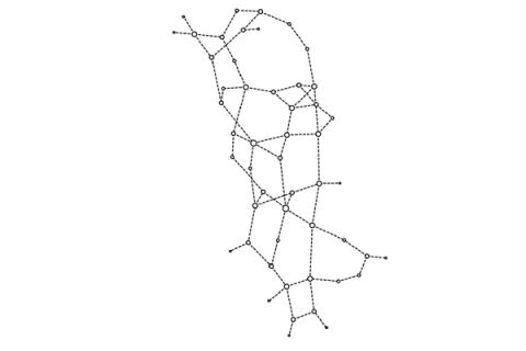
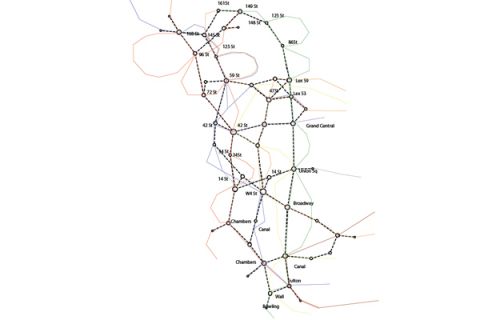
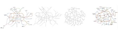
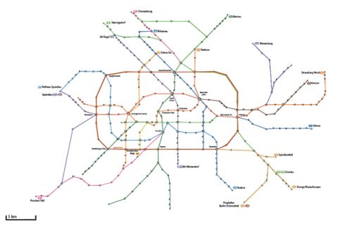
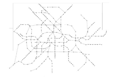
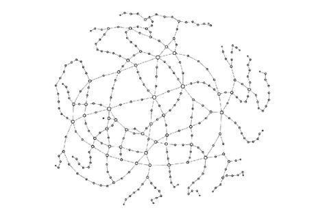
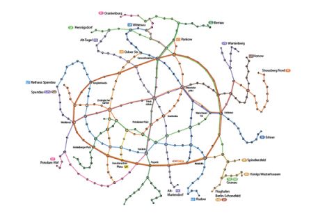
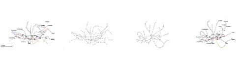
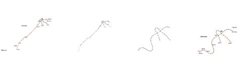
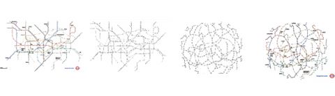
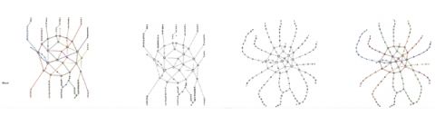
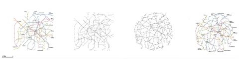
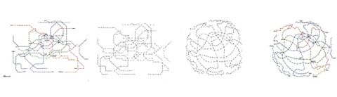
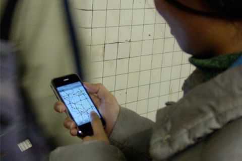
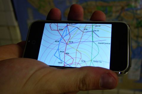
Subway Sorter is based on the idea that most essential information to the user of a subway network is the time it will take to reach the destination. Spatial information is secondary, as the space travelled is not visible. Subway Sorter inputs subway systems and re-organizes each segment on a time based scale. As the geography distorts a new map appears: Connection nodes between lines tie the system together, local stops in a line bulk out while the space between express stops shrinks, the linear shape of Manhattan inflates and wedges around the radiating satellites of Brooklyn, Queens and the Bronx. The systems of Paris and London re-organize to a grid-like map, while the star shaped plan of Moscow is resilient to the transformation. 

Implemented as an iPhone (1G) application in alpha stage Subway Sorter would feed on live subway operator data. Localization tracks the users position. The map re-adjusts and computes time and connections in a single dynamic map. 

Institution: aurel VR
Contributors: Aurel von Richthofen 
with Carlos Ramos da Silva and Sergei Mikhailenko
Year: 2011

NYC subway system transformation
NYC existing system
NYC nodal network
NYC relaxed network
NYC re-mapped network
Berlin BVG U & S Bahn transformation
Berlin existing system
Berlin nodal network
Berlin relaxed network
Berlin re-mapped network
Barcelona TMB subway transformation
Metro Dubai subway transformation
TFL London underground transformation
Moscow Metro transformation
RATP Paris Metro transformation
SMRT Seoul Metro transformation
App for iPhone 2G
close-up of the iPhone mock up
related: 

Brooklyn Smart Dots

Brooklyn Smart Dots originates in the radical re-conception of street traffic and proposes an intelligent surface of communicating luminous dots.

Parametric Urban Design Model / Qurm

Within the research project, we developed tools and methods to map these environmental, cultural and programmatic parameters into a cohesive urban design mechanism. This mechanism can be adapted and applied to any site in Oman or the Gulf region from the scale of a few houses to larger mixed use developments.

Compact City Oman

Compact city is a design for a sustainable neighborhood in Al Khoudh within the larger Muscat Capital Area based on cultural, climatic and economic criteria of sustainability. This model – both a research method to evaluate, interpret and integrate specific criteria of sustainability as well as a design proposal for a sustainable neighborhood - exemplifies an integrated approach to urbanism adapted to the local Omani conditions.

Wave Breaker

The “Wave-breaker” project challenges conventional architectural drafting methods as it is a land-art and landscape installation. The project narrates the story of seemingly abandoned industrial artifacts (the concrete precast wave-breakers) in a desert landscape.

Tetra – City / House

The house of the future is a tetrahedron. In fact, it is a set of tetra- shaped rooms forming a little city of tetra-spaces that form a tetra-shaped house. Fractal in geometry, the ideal house can be applied as ideal city on a different scale. Recursive in time, a partial realization anticipates the future expansion.

WITH/OUT WATER

The research project 'Architecture and Urbanisation With/Out Water' investigates the material, tectonic and social dimensions of architecture in its relationship towards water.